
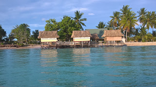
The Nippon Causeway
The Nippon Causeway is the
main link between the heavily populated island of Betio (site of the Battle of
Tarawa) and the other atolls in South Tarawa. It was built by the Japanese
government in the late 1980s and prior to that boat was the only link between
the main communities of Bairiki and Betio. The causeway is the only road
linking Betio to the rest of South Tarawa and was badly damaged a combination
of spring tides, strong winds and heavy rain following Cyclone Pam in March
2015.
The causeway is not without
controversy, some 3-4 kms long it is a vital connection for Tarawa but it only
has one bridge. Traditionally each tide would have flushed the lagoon and this
low lying gap between the atolls was one of the main points that the water
flowed into and out of the lagoon with each tide but now the causeway blocks this from happening. The lagoon on South Tarawa is no longer flushed clean every
day and so has become quite heavily polluted and is not safe to
swim, at least for westerners, though locals still use it for bathing, swimming
and going to the toilet (which is in itself part of the problem!).
Over the past few years the
main road running the length of the atolls has been sealed and I have been told
this has led to a major reduction in the
infant mortality rate as there is now a lot less coral dust being kicked
up by the cars, minbuses and trucks using the road. This work was done by
McDowell’s of New Zealand throughout the island but the section across the
causeway is unpaved as it is the responsibility of the Japanese to maintain/repair.
That being said the work is currently being done to fix causeway, repairing and
strengthening it and preparing for the new road surface. Of course this means that
the roading equipment brought over from NZ was returned there and no doubt
other roading equipment supplied by Japan will replace it- is that double
handling, less efficient use of money and resources? I’ll leave that to the
reader to decide but is pretty much par for the course in development circles.
Anyhow, since I’ve been here
work has progressed on the upgrade/repairs to the causeway and it is due to
be finished early next year and once it is completed will make a huge diffidence
to traffic flows and make it so much quicker nand easier to travel between Betio and Bairiki.
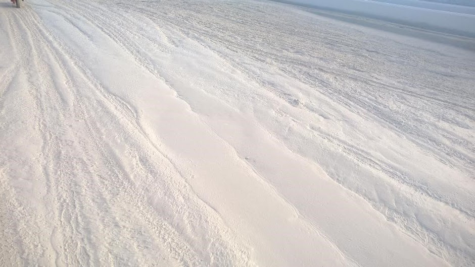
At present though, crossing
the causeway, as I do each day, is a bit frustrating. The roading crews put a
layer of crushed coral sand as the main surface of the road and it’s not
really fit for purpose- even a non roading engineer like me can tell that. The
surface is okay when dry, it is pretty hard but does slowly erode so is
constantly being replaced and smoothed over. The real problem occurs when it
rains, the coral turns to a weetbix like mush and is soon pock marked with
holes, some quite deep. Cars and other transport needs to wend its way
around the potholes and worst affected areas. Still, only a few months and it
should be fixed. In the meantime though….
South Tarawa

The causeway before it was damaged in 2015.

My first day in Kiribati- the repairs and strengthening of the causeway are evident.

Early April, as you can see work was continuing on the new seawalls. A hole in the reef which was blasted when the causeway was built to create a channel for boats and this created a great surf break and this shot is taken shortly before we headed out for a surf.

Biking to work. The Bairiki end of the causeway.

As you can see the surface isn't really ideal, it cuts up pretty quickly.

Traffic wending its way past the worst of the hollows, which are in evidence in the foreground.

The surface erroded after the rains last weekend and need refilling- a never ending job!

A tuck slowly making its way across the uneven surface.

At the Betio end of the causeway there was still quite a bit of mud.

Which we had to navigate to get to work.

When wet the surface is like weetbix!
Heading home after work, graders working on the Betio end of the causeway. You can see how little elevation between the high tide mark and the road there is. There is only about a metre of elevation hence the frequent issues during king tides.

Heading home after work, the lagoon is on the left and the new seawall is completed. It has 3 different channels to catch the water. It is on the lagoon side that most of the problems during king tides + wind seem to occur.

Tiabo
Craig


Craig - can I get permission to use your phot of the fabriform on the causeway in a paper of seawalls on atolls, please. For IEAust.
ReplyDelete